
Tuesday was another beautiful day here in the paradise that is known as Yellowstone. The Native American peoples that lived and worked here for hundreds maybe thousands of years before the European people arrived and announced they had discovered this wonderful place, called it the Land of the Yellow Stone. There were many more different kinds of stones here. One was the marvelous stone called Obsidian. It is a volcanic formed black glass stone that was used by hunter to make arrow and spearheads, as well as knives. Obsidian stone was traded from here to most of the rest of North America. (Geologist can tell it came from the Obsidian Cliff in Yellowstone).
But I get ahead of the story.
We drove east from our West Yellowstone hotel (after packing all of our stuff back in the suitcases and loading them into the vans) and drove to Madison Junction. We then head north to Norris and then to Mammoth Hot Springs and ultimately out of the north entrance to the park to our hotel in Gardiner, Mt.
We did do and see things on the way there.
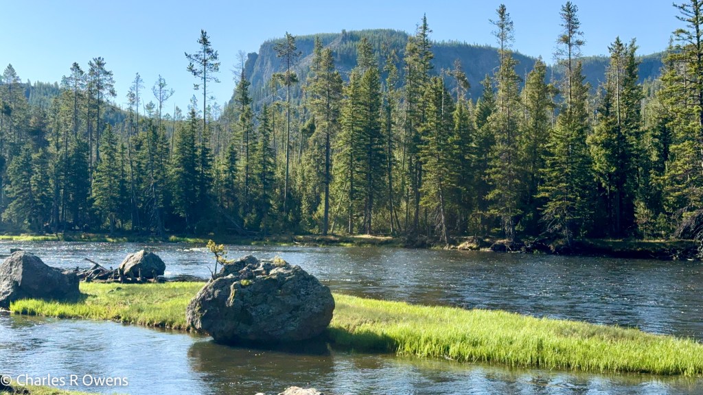
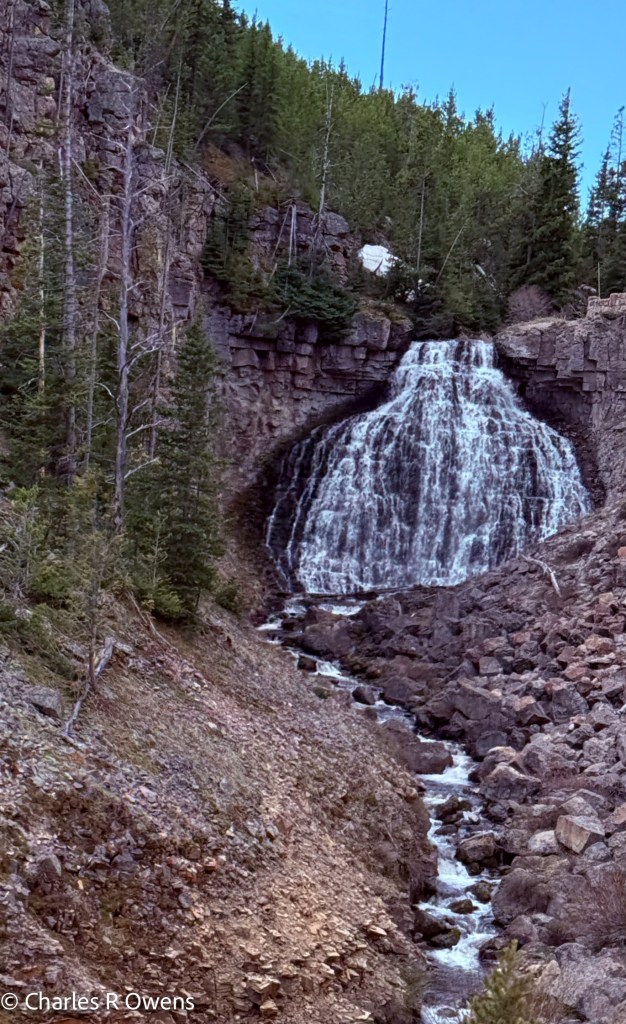
Our first stop (not counting bathrooms (I use that term loosely) was Gibbon Falls. Much of the road follows the Gibbon River. Gibbon falls is located in a valley where two Lava fields from two different volcanos met each other. The river carved a valley and there we find the falls. You may know that in several hundreds of thousands years (millions?) the water erosion will flatten down the falls and form a canyon with a lazy river at the bottom. But on this day, there is a pretty spectacular view of the falling water.
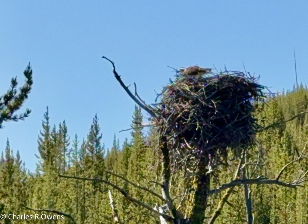
On the road from the falls to the main road an osprey had built a nest on the top of a tall tree down the hill from the road. Consequently, her nest was just about road level. We could hear the chicks in the nest asking for seconds as we drove by.
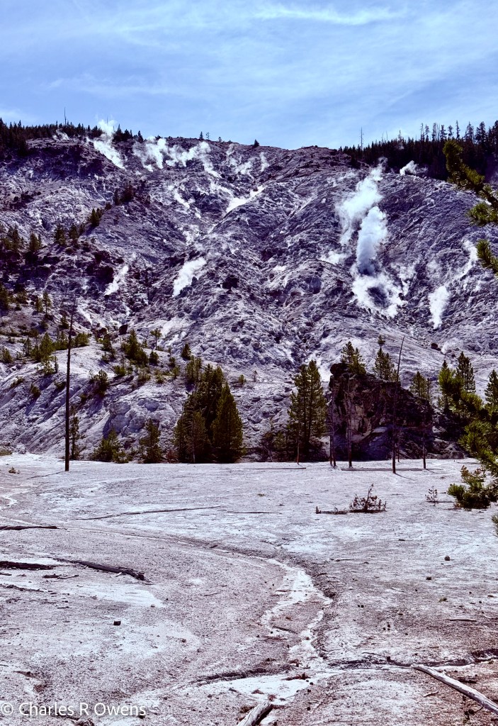
The next stop was Roaring Mountain. That has a large number of steam vents on the side of the mountain. At various time in the 1700’s and early 1800’s the steam vents made a great deal more noise than they have in recent years. Thus, the name roaring mountain was pinned on the mountain. It was still pretty noisy
The road then ran by the Obsidian Cliff I spoke of earlier. It was fascinating that traders carries the obsidian from her to places like New York and Florida. The people here like the Shoshone were the Bass Pro Shop of their day.
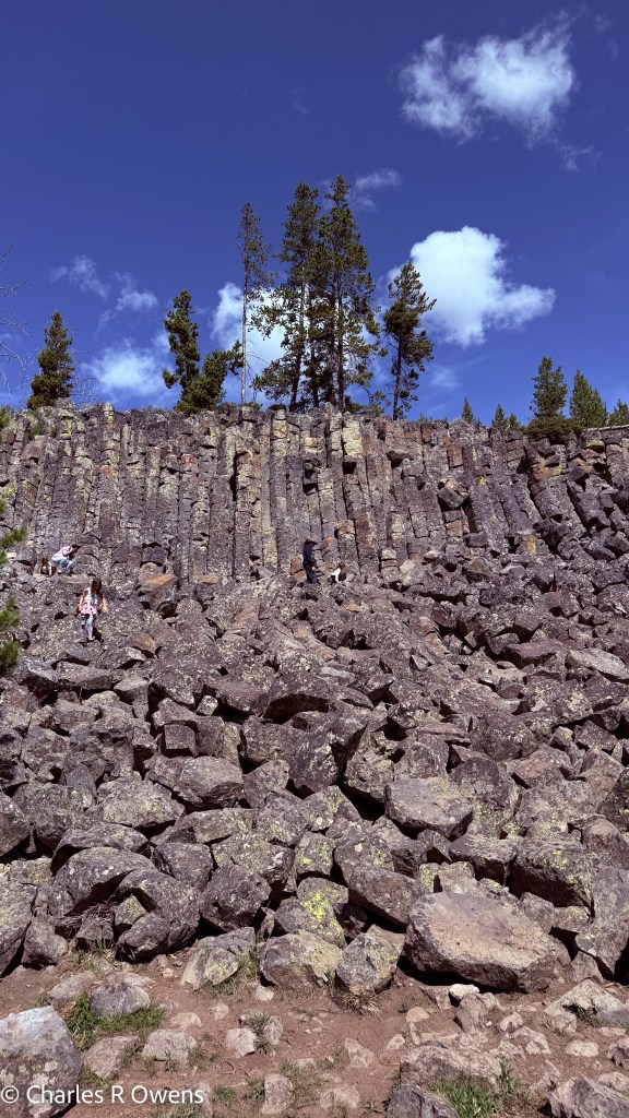
We stopped at the Sheepeaters Cliff area. The Shoshone Indians lived through out this region. They called themselves Tukadida, roughly translated as people who eat sheep. This particular cliff is the result of basalt lava flow that under the right conditions pours over a cliff and forms columnar shapes when it cooled around 500,000 years ago. The formations cracked and the outward columnar broke into blocks expose the next columnar. The blocks tumbled down in front of the columnar.
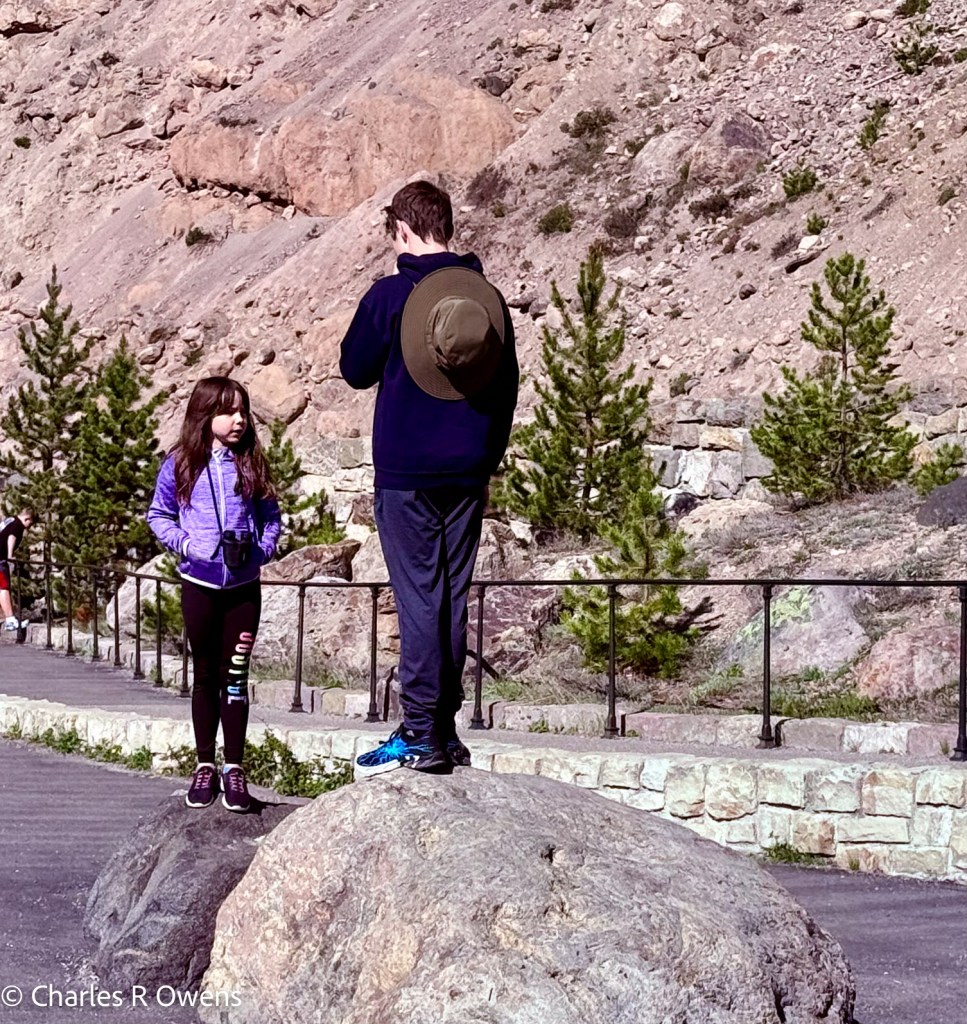
This leaves a really cool place for kids to go rock climbing.
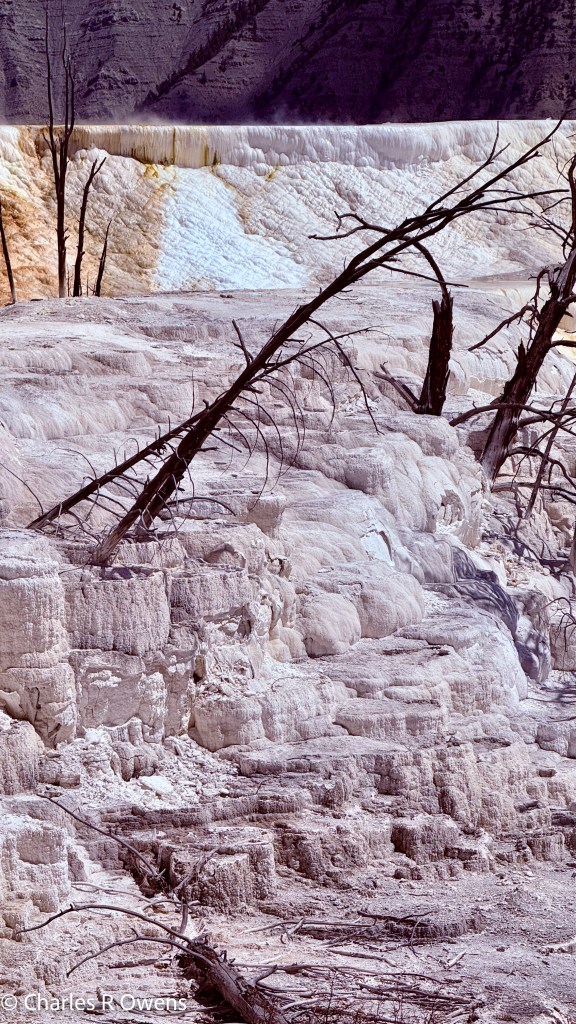
Our next place to visit was the travertine formations at the hot springs near Mammoth Hot Springs. The hot springs bring hot water that is filled with dissolved minerals in the water. As the water flow across the grounds the minerals settle out and become hardened rock. The formations can grow as much as 1/4 inch a day. The building formations and changing water sources result in spectacular terraces with many colors.
The main terrace can be seen from the Fort and hotel area of Mammoth. Our private guides Wes and Lorna took us around a short road to the Secret Narrow Gage formation, named that because the top terrace is about the width of the Narrow Gage railroad tracks. There was no train. But on our walk to see it we were virtually alone. The short walk was delightful and filled with wildflowers and the terrace was like walking back in time. No trace of human activity.
We then entered Mammoth Hot Springs which was and is the military presence in the park since it was founded. The Hotel has a very fancy dining room, and we enjoyed our lunch. Our waitress was a native Alaskan and was delightful.
Also in the Hotel Lobby is the map room. There is a large wall where a map of the then 48 states (1938) is constructed out of many kinds of exotic woods. The map illustrates not only the state boundaries but the main rivers and railroads that run the country. Cities are noted in small circles with names next to them. The state capitals are circles in a different color. Wes told us that the map has a mistake and one of the states has the wrong city as the capital. The city marked on the map is not the capital and the real capital is not even on the map. Our task was to identify which state had the wrong capital. We searched for a while and then asked for a hint. The hint was: it is east of the Mississippi. We searched some more and finally gave up. He told us that it was the State of ……. I am not telling you that. Come to Yellowstone and look for the mistake yourself.
We made it to the hotel around 3:00 and one room was ready, but the others were not yet cleaned. It seems that the summer works have not yet arrived for the season. The room that was ready was for the Shaw family of four. We hung out there for a bit. The kids went to the pool and had a good time.
We ate dinner at the Yellowstone Mine restaurant just next to the hotel. The food was good, and the decorations were reminiscent of a mine: lanterns on the tables, a rock wall and old mining equipment strewn about.
It was yet another good day.


Leave a comment